


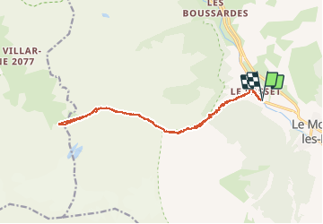
boucle Le Casset - col d'Arsine

seghth
User

Length
16.7 km

Max alt
2374 m

Uphill gradient
875 m
Km-Effort
28 km

Min alt
1507 m

Downhill gradient
876 m
Boucle
Yes
Creation date :
2020-07-09 09:40:02.091
Updated on :
2020-07-09 16:49:59.831
5h54
Difficulty : Very easy

FREE GPS app for hiking
 SityTrail
IGN / Geographical institutes
SityTrail Plus
The world is yours!
About
Trail Walking of 16.7 km to be discovered at Provence-Alpes-Côte d'Azur, Hautes-Alpes, Le Monêtier-les-Bains. This trail is proposed by seghth.
Positioning
Country:
France
Region :
Provence-Alpes-Côte d'Azur
Department/Province :
Hautes-Alpes
Municipality :
Le Monêtier-les-Bains
Location:
Unknown
Start:(Dec)
Start:(UTM)
301764 ; 4984295 (32T) N.
Comments